









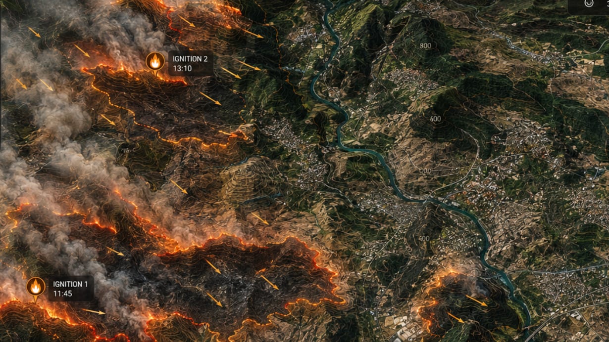

As France experiences an exceptionally severe fire season, an innovative platform called FireWatch is now operational to improve fire detection and management. Deployed by the Directorate-General for Civil Security and Crisis Management (DGSCGC) in partnership with the National Centre for Space Studies (CNES), this solution combines artificial intelligence, satellite data and rapid mapping to provide the emergency services with a tool for real-time forecasting and monitoring.
A tool designed with and for firefighters
FireWatch is the result of four years of collaboration between civil protection agencies, researchers, meteorologists and experts in geographic information. More than 50 departmental fire and rescue services (SDIS) were involved in its development, enabling the platform to be tailored to their operational needs. Among them are the SDIS of the Gironde, from the Var and theArdèche played an active part in the testing phases.
Since its operational launch in 2026, FireWatch has been used on a daily basis by the Interministerial Crisis Management Operations Centre (COGIC) and more than 40 regional fire and rescue services (SDIS), representing nearly half of the country’s emergency services. The platform automatically detects the outbreak of fires, including in remote areas or those poorly covered by traditional surveillance networks, such as certain parts of Brittany or Corsica. It also offers a fire spread simulation, helping the emergency services to anticipate possible trajectories and optimise the deployment of resources.
Key features for crisis management
FireWatch is based on several complementary tools:
- Automatic detection and real-time tracking : By analysing satellite data, the platform identifies signals from active fires and brings them together in a single interface, enabling the emergency services to monitor how they are developing.
- Propagation simulation : Based on the ForeFire model developed by the CNRS, this feature highlights the possible paths a fire might take, without replacing the decisions of operational managers.
- Analysis of the defencibility of buildings : FireWatch assesses at-risk buildings and their surroundings to provide information on their vulnerability and the measures in place to protect them.
- Rapid mapping 24/7 : For major fires, a mapping service updated several times a day is available, as was the case during the fires in Boussens (Haute-Garonne), Pouzols (Hérault) and Fontainebleau (Seine-et-Marne).
Since the start of the 2026 season, the rapid mapping service has been activated for 28 fires, enabling an assessment of the operational process from detection to the production of maps for the emergency services.
A response to the increase in forest fires
The 2026 season confirms the geographical spread and increasing severity of the fire risk in France, with more than 119,000 hectares burnt since the start of the year. Faced with a greater number of incidents that are more intense and often occur simultaneously across several departments, the Civil Protection services must be able to detect the outbreak of fires as early as possible and share consistent information amongst the various agencies involved.
“Against the backdrop of climate change, the emergency services must have rapid access to reliable, shared and immediately actionable information,” emphasises Lieutenant Commander Julien Berrivin of the Civil Protection Headquarters. FireWatch forms part of this initiative by complementing existing resources, such as the weather alert, through automated monitoring and a common operational interface.
A demonstration supported by France 2030
With financial support from France 2030 as part of its space programme dedicated to surveillance and crisis management, the FireWatch operational demonstration brings together the expertise of CNES, the SDIS and the Kayrros-SERTIT consortium. CNES has played a key role in translating the needs of the Civil Protection service into a service-oriented approach, whilst user feedback is helping to refine the platform under real-world conditions.
“FireWatch demonstrates the space sector’s ability to provide practical solutions to crisis management needs,” explains Gaël Scot, head of the Internal Security programme at CNES. The lessons learnt from this campaign will be used to prepare for the roll-out of the solution, in France and potentially across Europe, where the risk of wildfires is also increasing.
According to Simon Lamy of the Kayrros-SERTIT consortium, “France 2030 has provided us with a framework to adapt FireWatch to the working methods of the emergency services and demonstrate its value in real-life situations”. A detailed report on the results of this trial period will be published in the coming weeks.